BANDAR ABBAS BA CHART NO. 3599
Water Density: 1.27-1.28
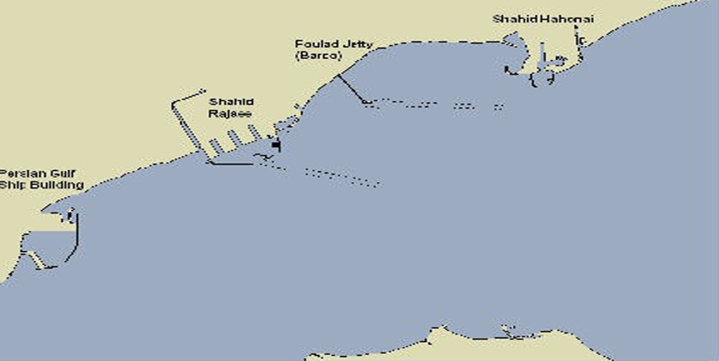
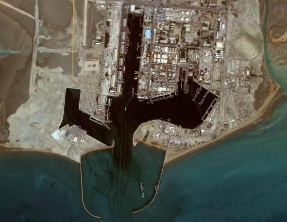
SHAHID RAJAIEE PORT COMPLEX:
Geographical position: lat .27o 07’ n long 056o 04’ e
Approach channel: 15 .5-meters draft, 6.5 km long ,249 m wide
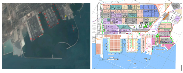
BERTHS SPECIFICATION
|
Berth |
|
Length |
Draft |
Berth |
|
Length |
Draft |
|
No. |
Purpose |
Meter |
Meter |
No. |
Purpose |
Meter |
Meter |
|
1 |
Oil |
230 |
11.5 |
17 |
General |
250 |
10.5 |
|
RO-RO<200 M |
|||||||
|
2 |
Oil |
230 |
11.5 |
18 |
General |
220 |
10.5 |
|
RO-RO<170 M |
|||||||
|
3 |
Multipurpose |
200 |
10.6 |
19 |
Multipurpose |
200 |
10.2 |
|
RO-RO<150 M |
|||||||
|
|
Please refer to item 3 below |
Please refer to item 3 below |
|||||
|
4 |
Container |
310 |
12.2 |
20 |
Multipurpose |
185 |
10.1 |
|
RO-RO<150 M |
|||||||
|
5 |
Container |
270 |
13.0 |
Please refer to item 3 below |
|||
|
|
|
|
|
||||
|
6 |
Container |
250 |
12.4 |
21 |
Multipurpose |
200 |
15.0 |
|
|
|
|
|
||||
|
|
|
|
|
22 |
Multipurpose |
220 |
15.0 |
|
7 |
Container |
210 |
11.3 |
23 |
Multipurpose |
250 |
14.0 |
|
|
|
|
|
||||
|
8 |
Container |
100 |
5.5 |
24 |
Multipurpose |
300 |
15.0 |
|
|
|
|
|
||||
|
9 |
General |
200 |
11.0 |
25 |
Container |
390 |
15.0 |
|
RO-RO<100 M |
Please refer to item 5 below |
||||||
|
10 |
General |
220 |
10.2 |
26 |
Container |
350 |
15.0 |
|
RO-RO<120 M |
Please refer to item 5 below |
||||||
|
11 |
General |
250 |
11.0 |
27 |
Container |
350 |
14.5 |
|
RO-RO<150 M |
Please refer to item 5 below |
||||||
|
12 |
General |
300 |
10.50 |
28 |
Container/Multipurpose |
230 |
14.2 |
|
RO-RO<200 M |
|||||||
|
13 |
Multipurpose |
300 |
12.7 |
29 |
Container/Multipurpose |
200 |
14.5 |
|
Please refer to item 4 below |
|||||||
|
14 |
General |
300 |
13.5 |
30 |
Container/Multipurpose |
200 |
14.50 |
|
Please refer to item 4 below |
|||||||
|
15 |
General |
300 |
12.5 |
31 |
Container/Multipurpose |
200 |
14.0 |
|
Please refer to item 4 below |
|||||||
|
16 |
General |
300 |
10.2 |
32 |
Container/Multipurpose |
190 |
14.0 |
|
RO-RO<250 M |
Please refer to item 8 below |
Priority for berthing RORO vessel as per sequence goes to Jetties 13,14 & 15 and then 12 & 16
Berthing of the vessels at Starboard side at Jetties No. 6, 7 19 and port side at Jetty No. 9 is subject to Port Maritime affair department’s confirmation.
Tankers at jetties 3, 19 & 20, considering the loading/discharging rate and tide water, can be berthed at higher draft than shown above, and after receiving permission from port maritime affairs.Bulk carriers with higher draft than shown about at jetties 13, 14 and 15, should coordinate with port maritime affairs giving information such as TPC, discharge or load rates.
Considering the draft of approaching channel at Shahid Rajaee Port complex, vessels can be accepted having max 15.5 meters draft at high tide water.
Above given jetties details and acceptance of vessels are subject to change after re-conducting hydrographic calculations at area , basins, getting views from Near-Miss committee and sea accidents and other related organizations.
Containers having higher LOA shown at jetties 4 , 5, 6, & 7, can be given berth only by coordination with port maritime affair office Berthing/un-berthing at jetty no. 32 is possible to be carried out in the day light, only.
In addition to the above PERSIAN GULF JETTIES located at the East and is part of Shahid Rajeiee port complex.
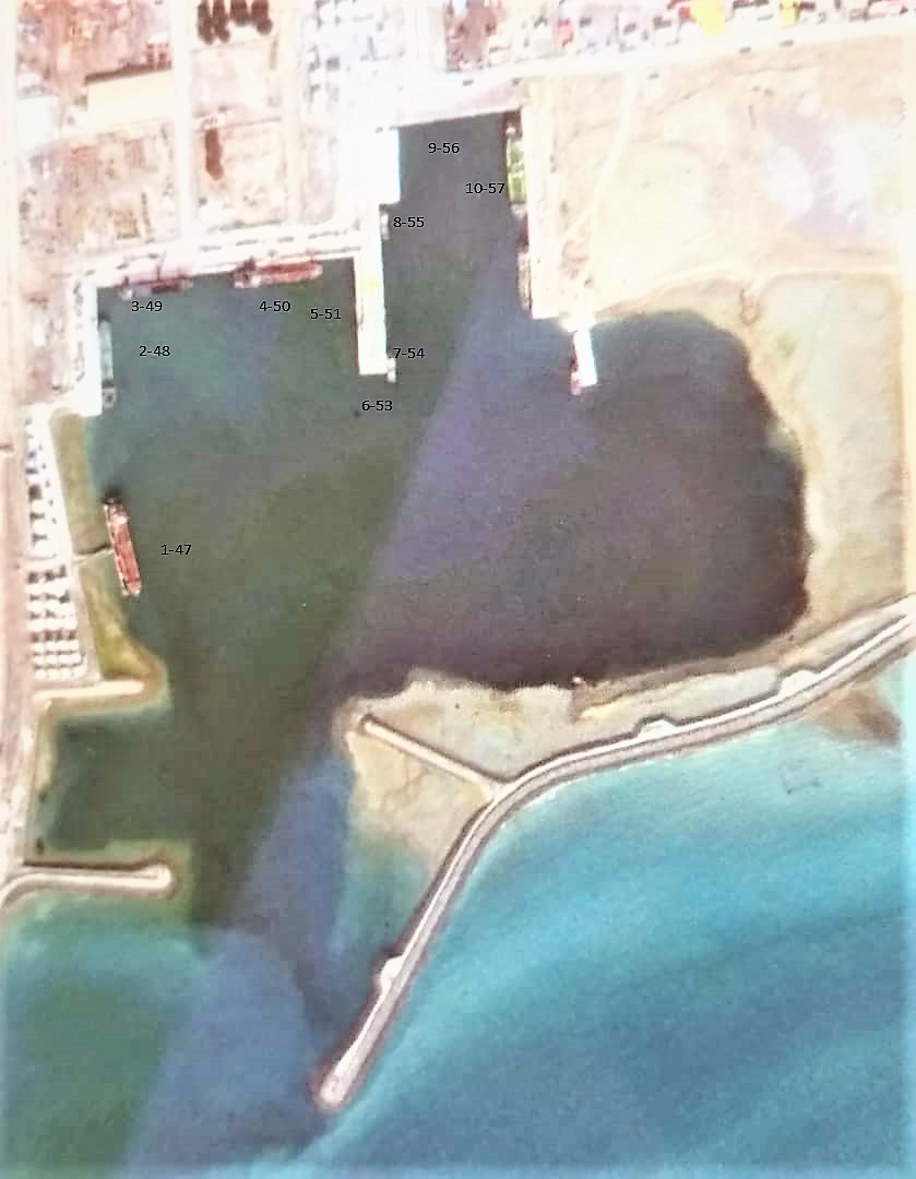
BERTHS SPECIFICATION:
|
Berth |
Berth |
Length |
Draft |
|
No. |
NAME |
Meter |
Meter |
|
1 |
47 |
150 |
7.50 |
|
2 |
48 |
100 |
7.00 |
|
3 |
49 |
80 |
7.50 |
|
4 |
50 |
150 |
7.50 |
|
5 |
51 |
115 |
7.50 |
|
6 |
53 |
125 |
7.50 |
|
7 |
54 |
125 |
7.50 |
|
8 |
55 |
125 |
7.50 |
|
9 |
56 |
70 |
7.50 |
|
10 |
57 |
<![if !supportAnnotations]>[MA1]<![endif]> 125 |
7.50 |
1-Vessels with higher draft than 7 meters will be berthed during high water
2-Berthing of the vessels from Starboard side at jetty No. 10 and port side at Jetty No. 1 are subject to the confirmation and confirmation of the Port Authorities
3- Berthing the vessels at berth No. 10 are subject to there are one tug or barge at berths No.7 and 8 or one vessel alongside these berths
4- Berthing of the vessel with higher than the above capacities are subject to confirmation from the port maritime office
SHAHID BAHONAR PORT
Geographical position: lat 27o 07’ n long 056o 04’ e
BERTHS SPECIFICATION
|
NO.OF |
|
Length |
Draft |
NO.OF |
|
Length |
Draft |
|
BERTHS |
Purpose |
Meter |
Meter |
BERTHS |
Purpose |
Meter |
Meter |
|
1 |
Fishing boats |
172 |
10.20 |
1 |
PASSANGER |
1 |
7.00 |
|
2 JETTIES 2-3 |
BULK/BB |
400 |
11.00 |
2(CHARLI 1 & 5) |
CRUDE OIL & LPG |
360 |
10.00 |
|
2 |
RORO/PASSANGER |
40 |
7.00 |
|
|
|
2 Berths maximum total length 400 meters allocated to load/discharge bulk and break bulk cargo Subject to prior arrangement the vessel is possible to be loaded up to 11.20 meter in high water .There are also two berths (Charlie 1 and 5) are used to load and discharge Crude Oil and LPG .
BARCO/P.G.M.I.S.E.Z PRIVATE JETTY
Geographical position: 55.05 E 27.10N

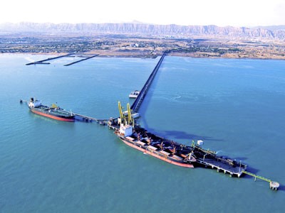
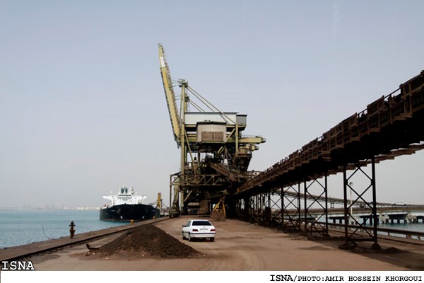
BERTH SPECIFICTIONS
|
|
|
Length |
Draft |
Beam restricion |
|
|
Jetty No. |
Application |
Meter |
Meter |
meters |
Remark |
|
1 |
OIL |
260 |
13.5 |
38.2 |
Berthing will be done at the end of High Water |
|
2 |
Mineral |
260 |
13.5 |
38.2 |
Berthing of laden vessels , will be done at the end of High Water |
Note:
1- Vessels will be berthed at PORT SIDE
2- Vessels should be free list
3- In case the ship’s squat at 5 knot speed at low water depth is higher than 20 centimeters, it should be deducted from the above table
4- Since the human faults are playing great rules in the sea accidents, hence for ship security, it is emphasized that precise calculation should be done by the Master and shipping line on their responsibility
5- The Ship’s negligence resulting accident or Near-Miss will be followed as per rules.
