
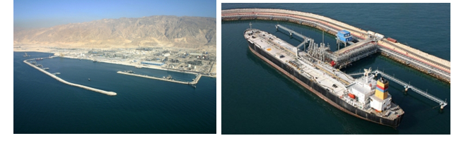
PARS PETHROCHEIMI PORT
Port operator: | TTPC |
Pilot boarding grounds: | 27 29′ N 052 32′ E |
SE entrance 27 31.62N’ | 052 32.87’E |
Water Density | 1.25 |
Anchorage located | 2.5 miles southwest of mainland. |
Tidal range and flow: | 1.2m |
Time zone: | GMT+3.30 1 HOUR SUMMER TIME |
Navigation charts: | 2883 BA chart |
Contact: | ASALUYEH PORT CONTROL 13 , 16 |
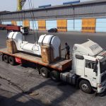
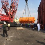
BERTHS SEPCIFICATION
Berths | Max depth | Length | MAX. VSL | Size loading | |
Meter | Meter | DWT/MTS | Arm (inches) | Application | |
1 | 32 | 42.6 | 70000 |
| Not in use |
2 | 30 | 42.6 | 70000 |
| Not in use |
3 | 25 | 42.6 | 70000 | 8-12 | Methanol,MEG |
4 | 23 | 42.6 | 70000 | 8-12 | Methanol,MEG, para–xylene,Rafinit |
5 | 20 | 42.6 | 70000 | 8-12 | Methanol, MEG, para–xylene,Rafinate ,Benzene |
6-12 | 14.6 | 430 | 70000 |
| Container |
13 | 14.6 | 300 | 70000 | Ship loader | UREA |
14 & 15 | 14.6 | 250 |
| 10 and 16 | Butane, Ethylene, Propane, Ammoniac, foam and Polyethylene |
LOADING LPG
LPG can be loaded at jetties NO. 14 & 15.
Manifold temp is about -40 dc for Propane and -4.0 dc for Butane.
Loading rate said to be Minimum 100 mt/hr and Maximum 1250 mt/hr.
Loading arms for Butane & Propane said to be 16 inch.
Ships are provided with Return Arm as well for depressurizing the tanks (if required).
LOADING CRUDE OIL
Here are five crude oil measurement apparatuses in positive displacement (PD) type that measures, liquid gas exportations in Assaluyeh Terminals with maximum measurement sum M3/H6500. Presently, the liquid gas transport to vessels is done by SPM SPMs.
Specifications of the computer
1– Receiving oil vessels in SPMs
Maximum capacity of accepting oil vessels in SPM 1: up to 300,000 tons
Maximum capacity of oil vessel acceptance in SPM 2: Up to 320,000 tons
Intensity of loading oil vessel: 5200 cubic meter per hour
2– Fire fighting system of the ball:
By using a tug fire boat
Water, foam and extinguishing materials products
3- Exact systems of crude oil measurement
4- 24-hour operations
5- Floating services
Operational Tug fireboat and boats for passengers / guide transportation
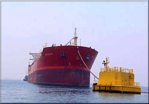
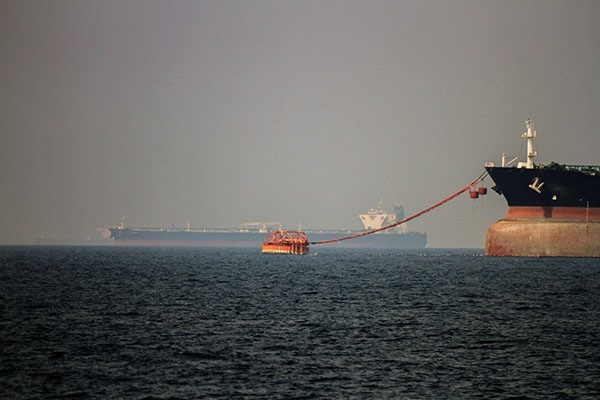
LOADING CONDENSATE
The loading at terminal is carried out via “SBM”
(SBM No.1) Position : Latitude 27o 31.5’ N/ Long 52o 31.5’ E (about 6 miles offshore)
Anchorage Position : Latitude 27o 25’ N/ Long 52o 25’ E
(SBM No.2) Position : Latitude 27o 30.4’ N/ Long 52o 31.0’ E (about 8 miles offshore)
Anchorage Position : Latitude 27o 25 N/ Long 52o 25’ E
(SBM No.3) Position : Latitude 27o 417’ N/ Long 52o 09.3’ E (about 8 miles offshore)
Anchorage Position will be advised by the terminals pilot
Vessels are moored to the SBM by to hawser lines
Two tugs are utilized during berthing operations. One tug stands by during vessel’s loading
Berthing/Loading at the terminal is carried out vid “SBM”, Using 16” flexible hoses
Maximum Arrival displacement allowed in 160,000 M/Tons
No limitation on departure displacement
Maximum allowable LOA IS 340 M.
Maximum Allowable deadweight at the terminal is 300,000 MT (VLCC vessels are acceptable)
There is no restrictions on height of the manifold
Average rate of Loading is about 3,000 MT/Hou